
As a primer to my article, it is worth reading the extract below first from the Wikipedia description. My thanks for the summary. Visit the Wikipedia page for all associated links. https://en.wikipedia.org/wiki/King_Arthur%27s_Cave
My article runs to several pages and all the analysed photo results are spread through it in their relevant places. I hope you enjoy 🙂
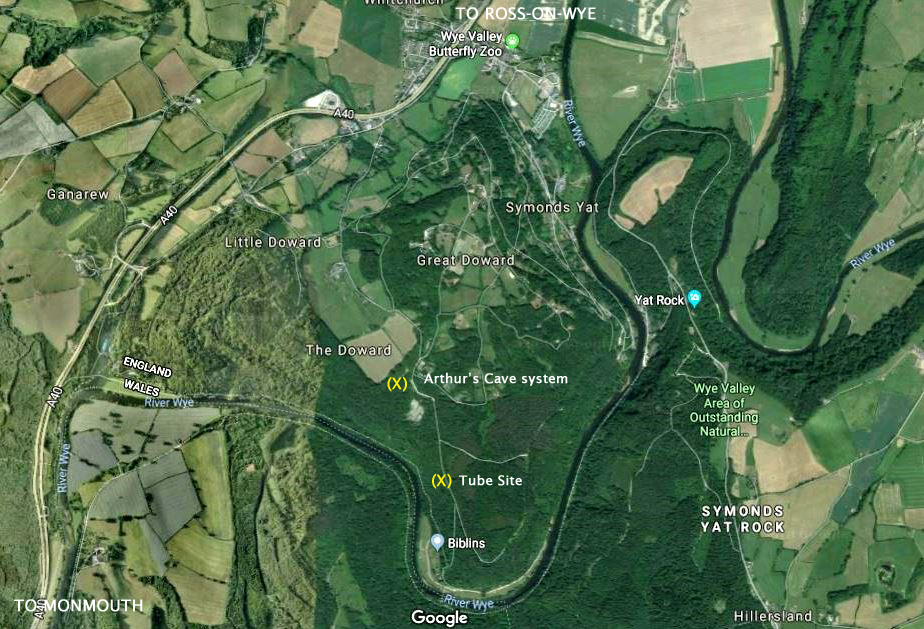
King Arthur’s Cave is a limestone cave at the foot of a low cliff at the north-western end of Lord’s Wood in The Doward, near Symonds Yat, Herefordshire, UK, about four miles northeast of Monmouth in the Wye Valley. The cave entrance lies about 285 feet above the River Wye on a hill with a double interconnected entrance and two main chambers. It is protected as a nature reserve under the Herefordshire Nature Trust. There is evidence that the cave was occupied by man during the Upper Palaeolithic era, and flint tools and woolly mammoth bones have been unearthed within and around the caves.
It is uncertain exactly how the cave got its name. A skeleton of a “giant human” was supposedly discovered in the cave around 1700, but was lost when a local surgeon named Mr. Pye took the skeleton to sea on a voyage to Jamaica and his ship sank.The cave is shrouded in local superstition and is believed to have had a part in the early legend of King Vortigern, a native British king who fought against the invading Anglo Saxons. Vortigern is said to have made his last stand against Aurelius at nearby Ganarew. Lawman mentions a castle on Cloard Hill in the district of Hergin, and has Vortigern dying after the castle was besieged and fired by Aurelius and Uther. Helen Hill Miller, in her 1969 book The Realms of Arthur, suggests a military use for the cave, arguing that the cave’s “recesses penetrate very far into the hill, and could hide a substantial force”. The cave has a parallel with Cadbury Castle in that it is a cave within a hill fort
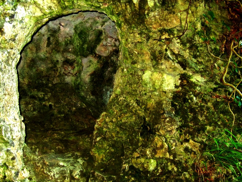
The Location ::: the top (X) marks the buttress formation and as (1) in the other pics.

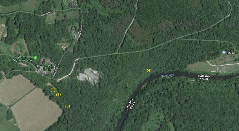
Other marked targets will become the subject of future articles.
///////////////////////////////////////////////////////////////////////////////////
For a considerable time I have been exploring and photographing the extensive system of limestone cliffs, caves and tunnels of the River Wye valley UK. Back at my desk I apply deep digital analysis to the photographs. Since discovering that illustrations cover rock surfaces all over the world, (invisible now to the naked eye) – I have been recovering them again through the analysis.
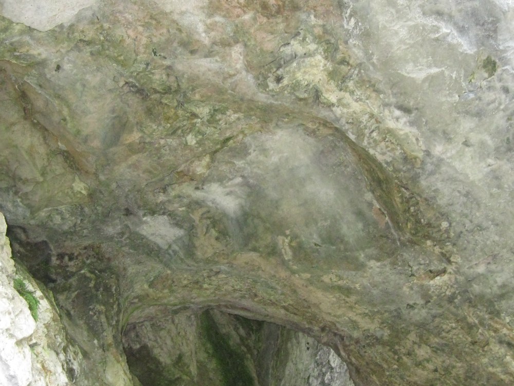
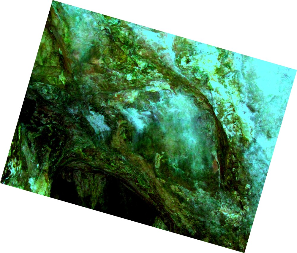
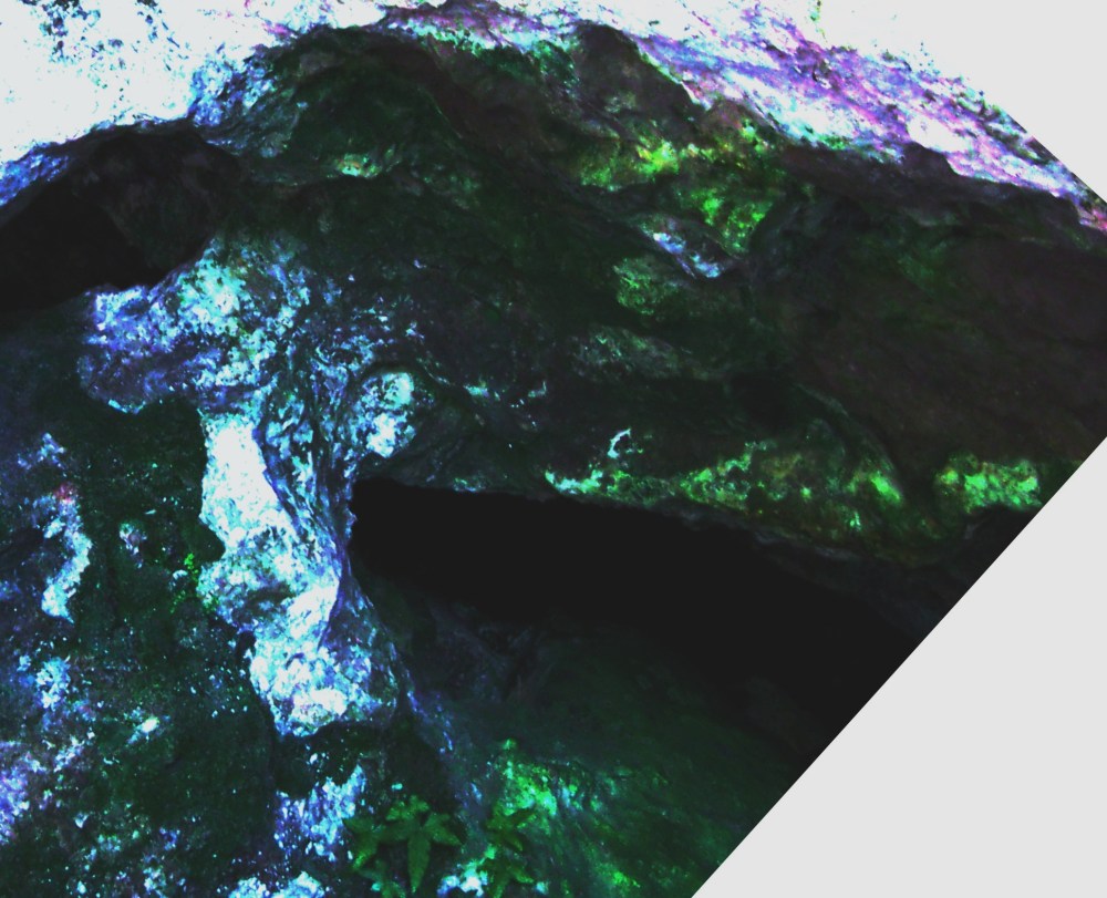
One of the latest picture results I shared on my Facebook platform attracted a question to explain it more deeply. The question led to this article because it was impossible to explain sufficiently in a couple of simple paragraphs. The picture showed the analysed result from the arch area of the buttress seen below. The article will explain in detail.
Firstly I have to tell you that I have an advantage through the analysis procedure because it lets me see the scene through lots of different colour frequency adjustments. Each adjustment neutralises or enhances a different part of the picture and allows the eye to see hidden sections of illustration more clearly than others. The versions I am sharing are the optimum versions to showing most detail.
When we look at rock surfaces our eyes and brain are generally satisfied with the predominant colour/s of the rock unless carved or unusually formed. The rock surfaces are a great canvas for us to pose for a picture so we can admire ourselves later at home. I scream when I spot a good target for analysis and a large section of rock surface is blocked by the shape of another selfie- poser. If only they knew what was illustrated across the surface behind them!
The digital analysis enables the predominant colour of the rock to be neutralised and for any tiny traces of surviving illustration to reappear. Some targets can take a very long time to analyse and all work has to be done on a full sized computer screen. Any study is almost useless from the screen of a tablet or smart phone. Even on a large screen, some work has to be done at a few hundred % enlargement down to single pixel level. Later study of the results must also be done Large!
In the UK near Monmouth and Ross-On-Wye where I live, the River Wye cleaves a circa 300 ft. deep valley through the landscape. It’s mainly limestone high banks are topped with abundant deciduous trees as a start to the ancient Forest of Dean. Majestic cliffs are hidden on the steep banks along with massive outcrops of rock which are peppered with caves and tunnels dating back to at least Palaeolithic times. One part is famously named The King Arthur cave system and it is a magnet for tourists; and this system has been extensively excavated since the early 1800’s. The caves however date back to the Palaeolithic and have yielded a zoo of predatory animal remains such as Hyena, Rhino, Bear, Lion, Beaver, Elk, and many more. It is worth noting that the style of illustration has greater affinity with the work of the Neanderthals many tens of thousands of years earlier. All of this can be researched at your leisure elsewhere.
But despite all the archaeological research done so far it seems no-one has picked up that the entire system was once adorned with astonishing, sophisticated illustrations of a nature that confounds all we have been taught about our simple ancestors. If this is so, how did I stumble upon them now? It is said that we only see what we expect to see so if we are not already tuned to discern ancient faded pigments, we will see only rock!
Several years ago I was analysing high definition pictures captured from within tunnels beneath the Giza Plateau. I spent a lot of time analysing the pictures because there were elements of colour and marking which didn’t seem to fit. Purely by chance I must have tweaked the adjustments to the perfect settings – and suddenly from one picture I saw the image of a person looking back at me. I nearly fell from my stool in shock!
The journey since then has been to an alternative history which no-one taught us about in school! Nearly five years on and the process has revealed staggering illustrations, invisible to the naked eye, barely surviving from a time and a people of high ability which history has forgotten. The best preserved results are from protected cave or underground surfaces.
The local caves systems of the Wye Valley just twenty minutes from my door are just one magic location (which we will return to in a moment,) but the implications of what they preserve are of a far greater order. We are faced with a lost paradigm and huge questions that may affect every one of us to truly know who we came from. The who? The how? The when? The why? ….But the thousands of target results so far have at least enabled some conclusions to be drawn because across the world, similar themes persist.
# Although the illustrations may show normal human figures, predominantly characters are depicted in theriomorphic form (ie. human bodies/animal heads)
# Creatures are abundantly depicted, often including extinct or exotic species.
# Illustrations are often hugely complex and regularly display cameo activities. Their realism does not appear to fall into any currently recognised style of painting, modern or ancient. We have often commented that a target result looks more like a photograph imprinted to the surface!
# Apart from the Theriomorphic inclusions, the scenes are often almost photographic in their quality and content.
# Scenes include contradictions such as where a jungle landscape may include pyramids, native villages, but also apparently modern city constructions and machinery.
# Some targets have included flying craft plus energy devices and extinct creatures of the sea and land.
# In Egypt we found that rows of figures in lines that wheeled out of the horizontal, were indicators of hiding places for artifacts. Likewise when rows right and left faced in unison, it indicated the deeper direction of a route. We successfully tested this observation in Egypt.
# Then there are the boats and ships! The strongest common feature of all, often shown with their crew as if in huge tumult battling the storm and waves ::: IE… In the Wye Valley emerging from caves, or accompanied by keepers of life and death. ::: In Canada where complex wreck illustrations led us to local folk lore of how the area was populated when the ancestors tied their boats to the mountain tops to land, survive and settle::: In Australia where a fleet of ships are repeatedly illustrated foundering in great storm near the region where we now know that Konshu’s fleet were lost along with their most important passengers…. And then contrastingly in the deepest (currently accessed) part of the NC2 cave system beneath the Giza Plateau… The same ship construction similarly depicted along with Ogham script referring back to Australian regions.. (The boomerang and kangaroo depictions helped.) Across the world, huge inundations are memorialised in these illustrations just like walls of record and it has been my current task to try and unravel the forgotten ancient history of our ancestors recorded in the Wye Valley throughout the King Arthur’s cave system.
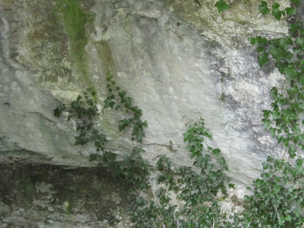
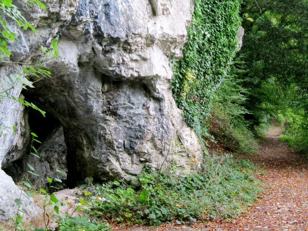
The system presents several strange deliberate formations and the target area heading this article is in the form of a huge rock buttress at the highest part of the system. A substantial track cuts past it now, but originally the formations would have been part of the sloping hillside leading down to a wide feeder valley for the River Wye. Currently the ground beneath the arch of the buttress drops down a few feet. We can judge that the ground generally must have been much lower thousands years ago and the arch would have been wider at its base. There is a cave adjacent in the outcrop with a very low ceiling, but this too would have enabled a comfortable walk-in height if the ground was lower.


I tried to picture the scene as it may have been thousands of years ago and it occurred to me that if, as we know from the archaeologists that this system was occupied in very ancient times, the buttress formation would have made a perfect gateway or guard station, before leading down to the rest of the system. If so, the adjoining cave would have been a perfect guardhouse. I had already found that rock surfaces and caves throughout the system were covered in images which seemed to focus on boats.. The climatic changes throughout the ending of the last ice age must have turned the planet into a very watery place. All over the world the predominance of boat and ship illustrations under tumult seems to support the universal truth of this event.
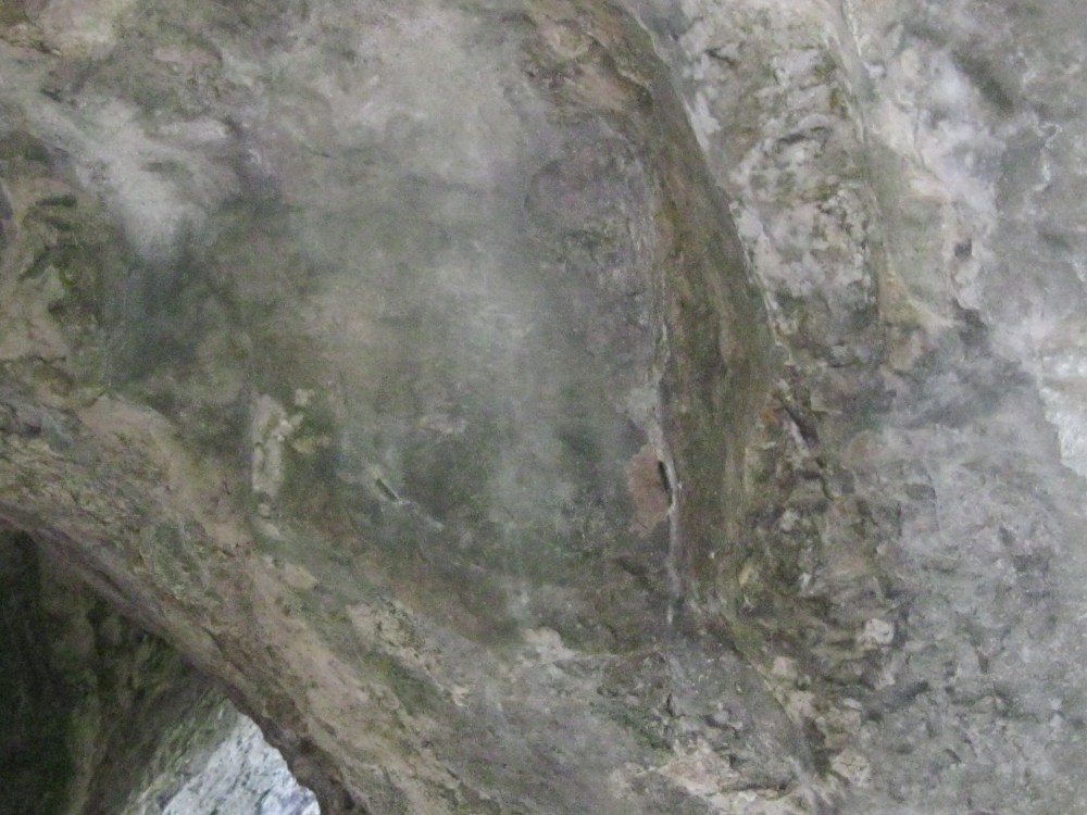
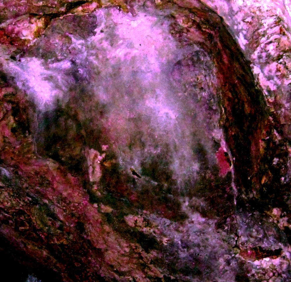
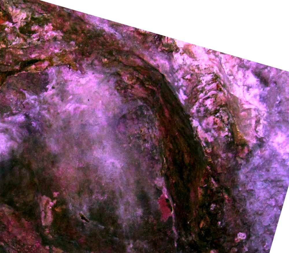
If anything of what I suppose about the buttress and cave are even half true, a visitor would have been greeted by an awesome display of illustrations memorializing or even celebrating the life and survival of the people in residence… At the top of the buttress arch the stone appears to be artificially smoothed – exactly at the point where the lead picture was captured.
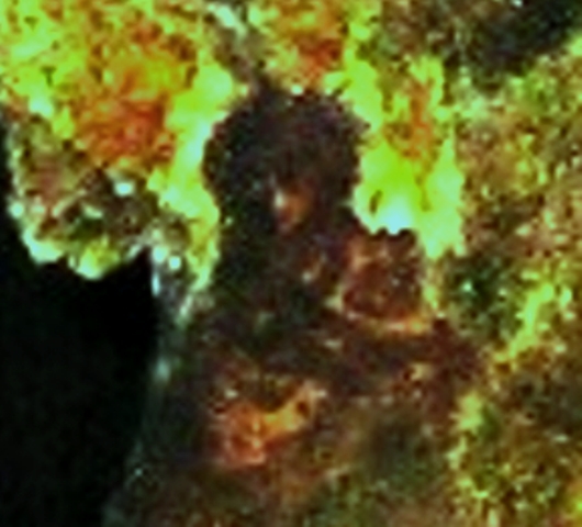
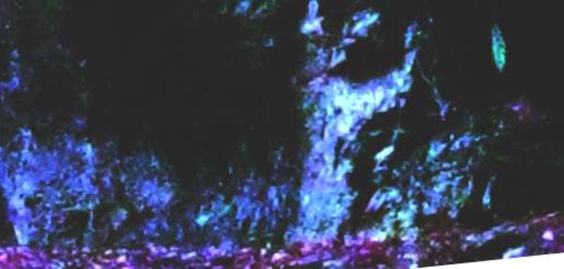
The complex illustration above the arch of the buttress replicates the real arch below. It depicts a deep cave with water flowing through. At least three crewed boats can be discerned emerging towards a lip where the water from the cave spills into a fall. On the surrounding surfaces, cameo groups of figures peer towards the central scene. Some of them appear vibrant and others deathly. Some are of monster size and some are only tiny. On the left, a lone figure seems to be directing towards the boats in some way, and even on the rim of the arch there is a line of animals curving around its shape. The following enlarged gallery shows the results :::

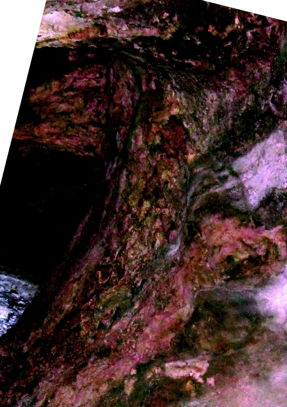


Below, we turn from the arch to the adjacent rock face :::

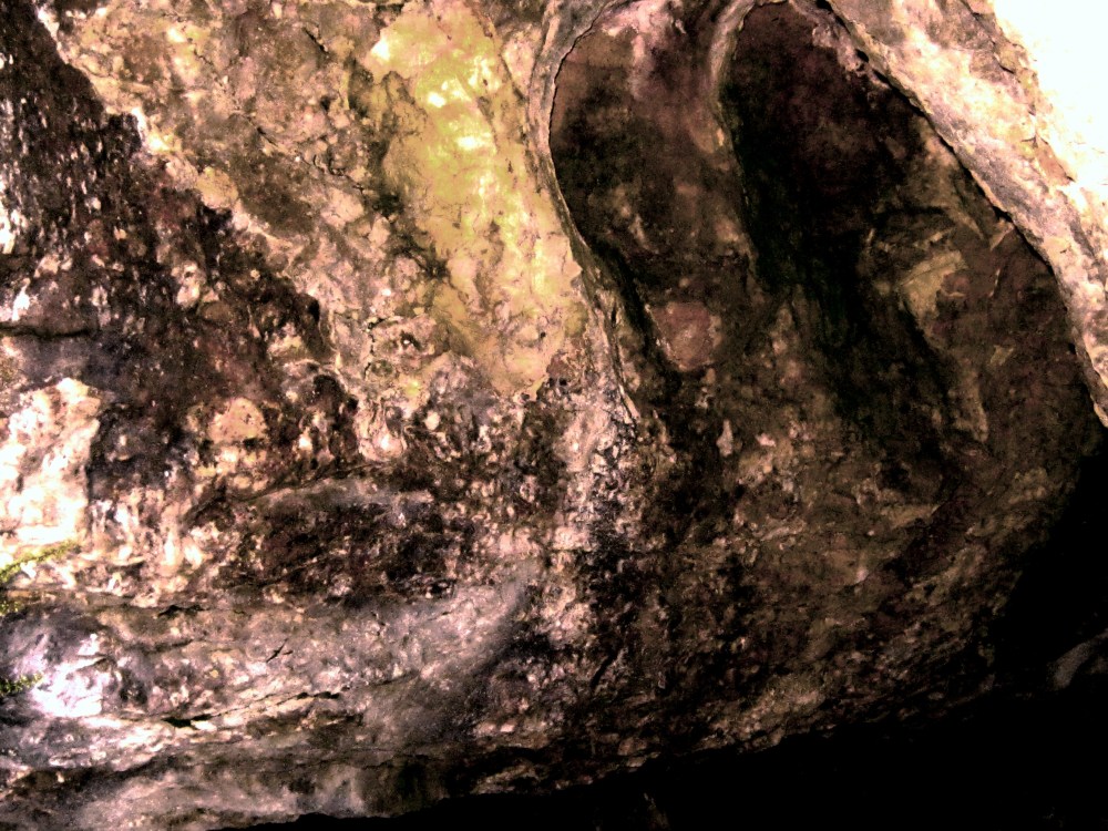
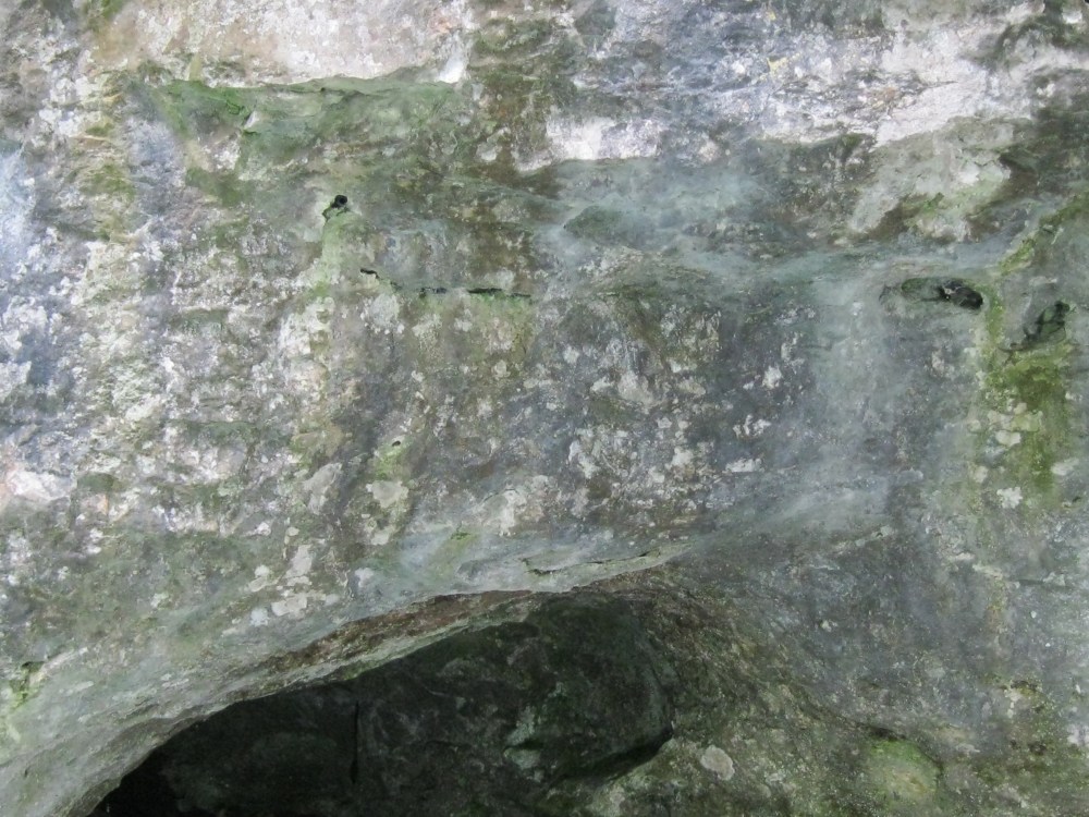
I can reveal also that on the substantial adjacent rock surface between the buttress and the neighbouring cave there is another large illustration depicting boats unloading at a quay beside a steep sloped hillside. The picture above is just one sample from it. Just as with the arch picture, there are varied types of onlookers everywhere peering-in at the scene. If this does constitute a wall of record, then general conclusions can be made. Life, function, survival and death are all represented. Above all there are the boats, indicating predominance in their world.
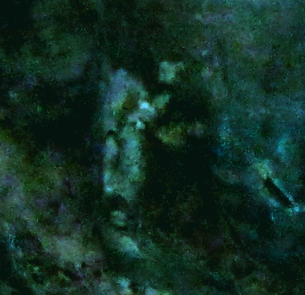
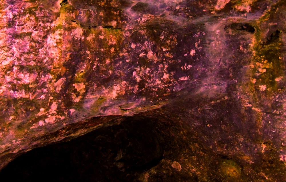
The following paired pics are from the low cave to the left of the arch…


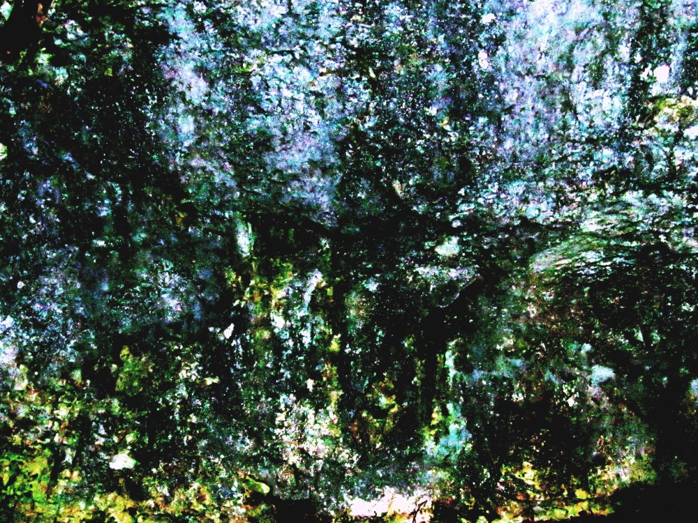
The next one taken from the pic above… Just like any other of these pics., if you can copy/save them to your own full screen and enlarge them, you will discern so much more detail. In this case, the mess opens out to show middle/center rows of figures are arranged around a campfire. The whole of the frame is busy but it will take more work to extract the full scene.
It can also be no accident that figures everywhere are shown in theriomorphic form. There was clear purpose to it, but what ? Remember how this tradition continues into the modern history of Egypt with human/animal hybrids.. Could it be that we used to have a genuine symbiotic lifestyle which bonded us so closely with animals that this was honoured everywhere in illustrations of half human, half animal figures – and later as god symbols?
The detective work is at its infancy because the presence of the almost lost illustrations is a refreshed memory thanks to modern digital technology and pure luck to make a first rediscovery from beneath the Giza plateau. This discipline of photo archaeology is completely non-invasive, non-destructive, and can be developed by absolutely anyone with a passion to study the surfaces and practice the analysis. Instead of being beholding to the establishment version of our ancient past, anyone can go out there unfettered and re-examine all that we thought was true. Perhaps also this will generate a healthier respect for ancient rock surfaces and elevate them from being a simple backdrop for people poses, to potential sites of ancient illustrated experience.
I have literally thousands upon thousands of results that test the mind to the limit, and in the case of the Wye Valley rock systems I will continue to draw them together sufficiently to offer them in a decent presentation to the archaeologists and historians. Faced with their stark reality there will be no turning away from the weight of their inconvenience and implication. I hope with all sincerity that many other people out there will emerge to do this work and speed the process. Let this article be a starter.
//////////////////////////////////////////////////////////////////////////////////////////
I am adding here a few samples from elsewhere in the area as a little bonus spoiler. I will be producing separate articles for each target site.. They are all provoking. and further down the article there are some more…

Picture below, analysed from the one above


Picture below, analysed from the one above

……………………………………………………………………………………………….
How do I believe the process works?
When a normal photo is manipulated with PS.Elements, the software creates a separate layers for each process. As we work on the photo, we usually see them as one pic, but before saving them, we have to merge the layers we have created.
If a rock face was smoothed in ancient times to become highly illustrated it then faced centuries of aging, perhaps enduring instability, weathering, erosion, calcification, heaped detritus.
The camera taking the picture similarly flattens the degraded surface to a single imaged layer.
The adjustments are then able to neutralise the predominant colour and through infinite combinations can assist any surviving illustration pigments to show through again. Further digital work can recreate depth just as it was intended in its original state.
The practiced eye and brain are able to join the dots where degraded parts have not survived.
Finally, I learned at an early stage that there must be another test of credibility. I reject so many targets because although I can see surviving illustrations, they are not substantiated in a complete scene and/or they do not have sufficient definition.
In other words, a target must clearly display all the credible and recognisable elements of a complex scene for it to go into the save folder – and I am my own worst critic at this stage.
And to say again ::: From analysis to presentation for study, the whole process MUST be done on a full sized computer screen with further magnification capability.
Technical information for anyone with serious intent to make their own discoveries :::
My photo equipment includes (1) An ordinary Canon Power-Shot Camera set at Highest Definition. (2) A recent (expensive) L16 Light Camera, giving over 50K pixel ultra HD definition.
For analysis I simply use MS Office 2010 photo analysis. This gives infinite adjustment combinations for :: Brightness/Contrast/ Midtone/Highlight/Shadow /Saturation + Colour variance through the spectrum via Hue and Amount (heat) The way these are manipulated enables changes either to individual pigment frequencies or to the frame as a whole.
Definition I achieve this by preference using PS Elements9. From years of practice I am able to comfortably use a cordless mouse to delineate the slightest change of colour or shade down to single pixel level – and of course the frame can be fine-tuned through all of the duplicated controls of Office 2010.
The whole process to an optimum result from a single best target can literally take me hours of time, especially if I move on to delineation and shading, but in doing so I am able to refer to saved frames from several colour versions which show particular aspects more clearly.
I hope this article will generate only serious interest and hopefully serious feedback from those of you who are inspired to try the process yourselves.
Also as much as limited time allows I will continue in confidence to check out any HD pictures sent to me for examination. I have been doing this quietly for years for a substantial number of other serious independent researchers out there and I thank you all for your trust and confidence. You all know who you are, and I hope the results have spurred you on with your own work…. Photo archaeological research is a path which will expand for generations to come and although this life won’t give me enough time to see it completely rewrite history, I am so glad that I have been able to play a part…. Enough for now… There’s work to be done
By the way – for the Wye Valley cliff, tunnel and rock system, this is just a starter. I have been working for some time on other sections which have yielded genuine new secrets. I will be featuring these in a continuing series when they are ready. Please benchmark my FB & Word Press blog.


…………………………………………………………………………………………………..
One last spoiler-alert for the large caves at the lower end of this system where the alleged giant was discovered.. I will show the illustrations from here in another article. But while tourists get excited about the caves… just along the cliff face the rock surfaces are heavily carved and illustrated… Take a look :::
From This :::::: A low view of the largest caves ::::

Zoomed in on the right to reveal this !!!
Richard Gabriel – 4th October 2018
